Organisers:
Paul Bons & Oliver Vonderschmidt,
Inst. for
Geosciences,
Tübingen University
Sunday 22 March - Monday 6
April,
2009
Please check this site
occasionally
for updates! Last update 01 December 2009.
Please note:
Bring your lunch and food for dinner the first day with you.
You can cook or BBQ in the
bungalows in Garriguella the first evening. There is no time for
shopping on the way up, and if we arrive late, restaurants in
Garriguella may be closed. We will stop at a supermarket on the way
from Garriguella to Castellote on the 27th.
Be on time so we can leave at 7:30 AM from the museum
(Sigwartstraße).
It is a long drive to
Garriguella, about 1160 km, and we do not want to hurry. Speeding is
NOT allowed!
| Table of contents:
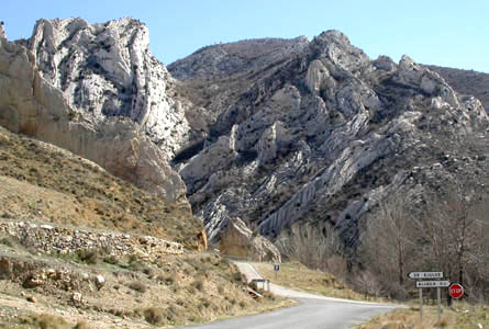
Folded limestones , near
Aliaga
|
 |
Introduction
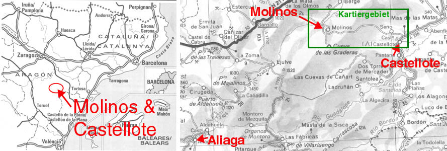
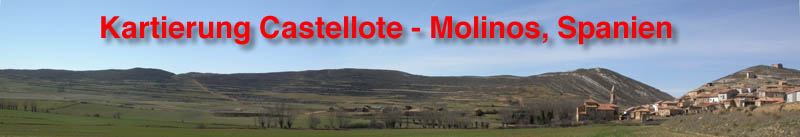
The mapping area is around the villages of Molinos and Castellote in the north of Teruel Province, in northeastern Spain. The area is hilly, with elevations around 1000 m. Vegetation is very sparse, so outcrops are excellent in the rocky landscape.
Rocks in the area
are
of Jurassic to Cretaceous age, mostly limestone and marl layers.
Triassic
and Carboniferous rocks appear here and there in the cores of large
anticlines.
In the Tertiary, the area was deformed into a fold-and-thrust belt. At
the same time, large packages of conglomerates were deposited in small
local basins. The sediments contain many fossils: snails, shells,
brachiopods, ammonites, and occasionally a piece of dinosaur-bone.
Fossilised wood
can
also be found.
Schedule
It takes about
one and
a half day to drive to Castellote, where we will be based during the
field
trip. An introduction into the local geology will be given on the first
day. The rest of the time will be spent mapping in
groups of 3 students in areas of about 2 x 2 km. The field is rocky,
so bring sturdy field boots. Although rocky and hilly/mountainous,
there
are not many steep slopes and one can walk pretty much everywhere.
---> Anyone with a disability or problems with getting around in the field should contact the organisers to discuss a suitable area.
- 22 March, 07:30 AM - Departure from Tübingen. The night will be spent in Garriguella, just across the Spanish-French border
- 23 March arrival in Castellote
- 24 March-
Introduction
into the local geology and stratigraphy
- 25 Sept - 03 Oct: mapping in the area around Molinos and Castellote
- 04 April: hand in map + report. Visit to the
Castellote Castle & Crystal Caves
- 05 April,
departure, travel to Garriguella. Time permitting, visit to Dali Museum
and/or Cap de Creus
- 06 Aprl, arrival in Tübingen in the evening
- BE ON TIME!
Accommodation We will stay at the campground of Castellote, a small village near the southeast corner of our mapping area. Here we rent 6-person bungalows, with beds and kitchen. No need to bring a tent or cooking utensils, but bring sheets/sleeping bag. On the way we will also stay in bungalows. Each bungalow has 2 bed rooms and a living room. The bed rooms have 2 separate beds (Castellote) or 2 beds in one room and 1 double bed in the other. There is a 2-person couch/bed in the living room. There will be 6 persons per bungalow, so at least 2 persons per bungalow have to share a bed or couch.
The campground is about 3 km away from the actual village. Every day there is time for shopping in the village (2 small supermarkets) and in the morning we will stop to buy fresh bread for lunch in the field.
Address:
Camping Castellote
Carretera del Pantano, s/n
44560 Castellote - Teruel
Tel.: +34 - 978.88.75.76
URL: http://es.turinet.net/empresa/c.castellote/
For emergencies: mobile
phone
Paul Bons: +49 - (0)160 - 5515482 (SMS preferred)
Costs
The fee includes travel and accommodation.
Food and drinks are not
included.
What to bring
| Geological items |
|
| Apart from
usual clothes
and personal items: (please keep to a minimum to reduce luggage!) |
|
| Eating and sleeping |
|
| Health & Safety |
|
Picture gallery (pictures were taken in March)
 |
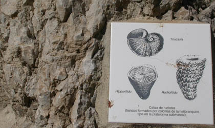 |
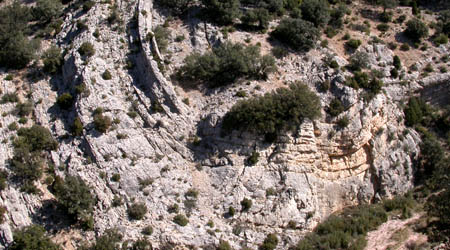
| In Aliaga near Molinos the layers are almost vertical and we can see the whole stratigraphy from Jurassic to Tertiary. | Rudists are one of the many fossils one can find. Rudists make riffs that form ditinct ridges in the landscape. |
 |
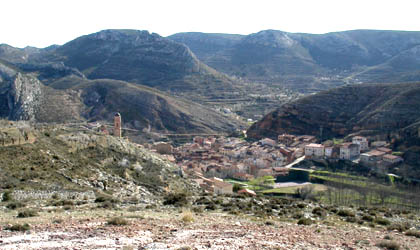 |
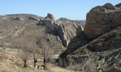
| Folded limestone layers near Molinos | The village of Molinos, surrounded by the mapping areas |
 |
 |
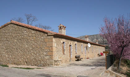
| Accommodation at the campground of Castellote in
March |
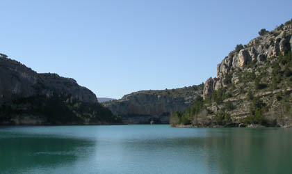
The lake next to the campground of Castellote |
Some links:
- camping de Castellote: http://es.turinet.net/empresa/c.castellote/